Background
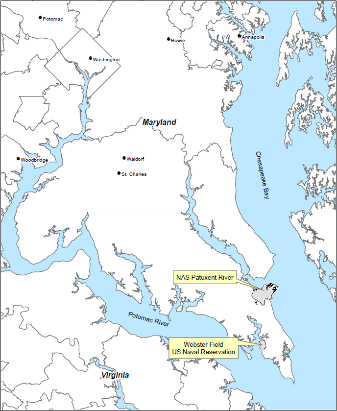
Webster Field, under the command of Naval Air Station (NAS) Patuxent River, is located in St. Inigoes, Maryland, approximately 15 miles by road south of NAS Patuxent River. Established in the early 1940s, Webster Field comprises approximately 850 acres. The facility was originally used as a dispersal field in the event of aerial attacks during World War II and as an auxiliary landing field for NAS Patuxent River. The facility is currently used principally for the Naval Air Warfare Center Aircraft Division (NAWCAD), Coast Guard Station-St. Inigoes, and the Maryland Army National Guard.
St. Inigoes Creek borders Webster Field Annex to the northeast and St. Mary’s River borders Webster Field Annex to the north and west. The topography of Webster Field Annex varies from gently rolling to flat. In general, the topography of the site tends to slope gently from the northeast to the southwest towards St. Mary’s River, which empties into the Potomac River. The elevation at the east end of the northeast/southwest trending runway is 21 feet above mean sea level and the elevation at the west end of the runway near St. Mary’s River is approximately 12 feet above mean sea level.
Webster Field Annex is in the Coastal Plain physiographic province, approximately 50 miles southeast of the Piedmont physiographic province. The Coastal Plain sediments consist of a thick sequence of unconsolidated sand, clay, and gravel that dips gently (less than 1 degree) to the east and southeast (Fred C. Hart and Associates, Inc., 1984). The thickness of the sedimentary units varies from approximately 2,000 feet in the northwestern part of St. Mary’s County to 3,000 feet in the southeastern area of the county. Near Webster Field Annex, the unconsolidated Coastal Plain sediments overlie crystalline rocks.
The regional hydrogeological system of the Coastal Plain near Webster Field Annex consists of several aquifers within the geologic units discussed above. From shallowest to deepest, the aquifers of primary interest with respect to Webster Field Annex are the surficial aquifer, the Piney Point-Nanjemoy aquifer, the Aquia aquifer, and the Patapsco aquifer.